Route distance: 23,860 Km on foot (+ 1,929 Km Santuari del Tallat, + 6,950 Km Rocallaura)
Estimated time: 6h 30' on foot
Maximum height: 771 m on foot
Minimum height: 388 m on foot
Accumulated gradient: On foot, 1.202 m (uphill: +586m; downhill -616 m)
** This tour should be a stretch because there is no middle village with accommodation.
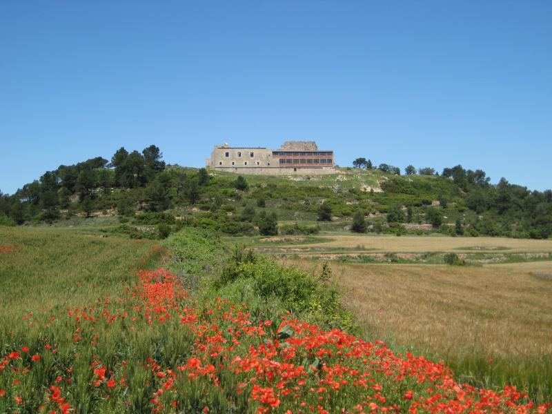
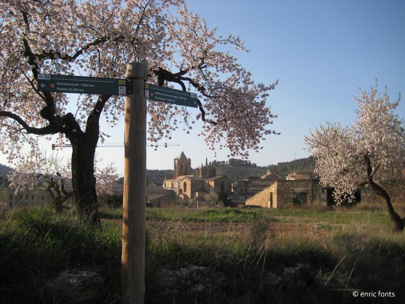
We leave Poblet Monastery towards l’Espluga de Francolí on the TV-7007 road. We link up with the TV-2336 in Blancafort and we continue along the GR175 on rural paths and trails among fields and vineyards and small woods. At km 13,300 in Mas d’en Jover we continue along the Cap de Coll by pass for bikes that follows along the path until we reach the Omells road and continues up to Cap del Coll. We continue along the trail in Sierra Tallat wind-farm.
At km 16.630 find the path that leads to the Sanctuary of Tallat. 2km must add to and further the sanctuary of total length.
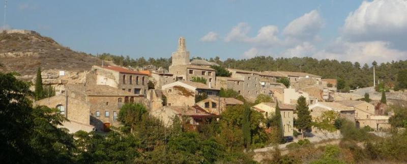
We continue along the GR175 on trails among fields of cereals and small wood of pine and oak trees that takes us to Montblanquet. We continue along the LV-2338 road until we reach the path to Rocallaura at 200 metres. We continue along the road path that goes up and, later on, along a rural trail with descents and small, very gentle up hill’s until we reach the path that takes us to Bosquets where there is a view of Vallbona Monastery. Some stretches are still stony and deteriorated by rain and motorbikes. Slight descent to the Maldanell Stream where we continue along the asphalt path until we reach Vallbona de les Monges.
*** until Rocallaura. We leave Vallbona along carrer Major towards the road or suburb to Tallat where we take the slightly upwards path with lots of loose stones. We continue flat until we link up with the rural trail of Rocafort de Vallbona to Belltall. We go up a bit along the highest part of Sierra Senadelles, among pine and oak woods and fields of cereals for about 3 kilometres.
A fire in the municipalities of Vallbona, Nalec and Ciutadilla, on July 20, had burned 1,400 km. through the GR175, between Vallbona (to 5 km.) and Rocallaura (to 1 Km.) Turó de l'Isidre. Is really bleak landscape.
From this point we go down until we cross the Maldanell Stream where we climb to the village of Rocallaura. Attention: to go to the accommodation before arriving in Rocallaura, a crossing on to the right that leads directly to the two establishments, since the two are located outside the city center.
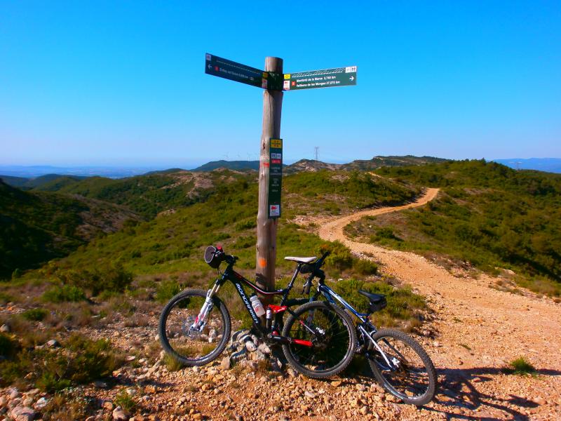
BIKE RIDE
A variant is scheduled for cyclists in the Coll de Montblanquet to avoid the path from Mas Jové as far as Cap de Coll.
GPS TRACK DOWNLOAD:
APPROXIMATE DISTANCES:
BY FOOD:
- Km. 2,600 - L'Espluga of Francolí.
- Km. 14,370 - Cap del Coll.
- Km. 16,830- Road to the Sanctuary of Tallat. Must be added to the course 1.780 km in total.
- Km. 17,730 - Sanctuary of Tallat.
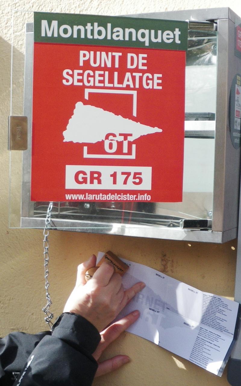
- km. 20,400 - Montblanquet.
- Km. 25,660 - Vallbona de les Monges.
MTB:
- Km. 2,600 - L'Espluga of Francolí.
- Km. 12,430 - Mas d'en Jover.
- Km. 13,300 - Beginning of variant MTB.
- Km. 14,910 - Stretch of road to Cap del Coll.
- Km. 16,900 - Coll de Variant of MTB Cap del Coll.
- Km. 20,220- Road to the Sanctuary of Tallat. Must be added to the course 1.780 km in total.
- Km. 22,190 - Montblanquet.
- Km. 27,260 - Descens to Vallbona de les Monges.
- Km. 29.330 - Vallbona de les Monges.
WATER POINTS:
Fountains in Espluga de Francolí, Montblanquet and Vallbona de les Monges. It is recommended to provide water. Until you can do Montblanquet long journey.
ACCOMMODATIONS:
Accommodations that relate to those involved with the CARNET 6T and you will find in this section. Other accommodation click HERE.
Accommodations in l'Espluga de Francolí.
- Fonda Ocell Francolí. Tel. 977 87 12 16 - http://www.ocellfrancoli.com/
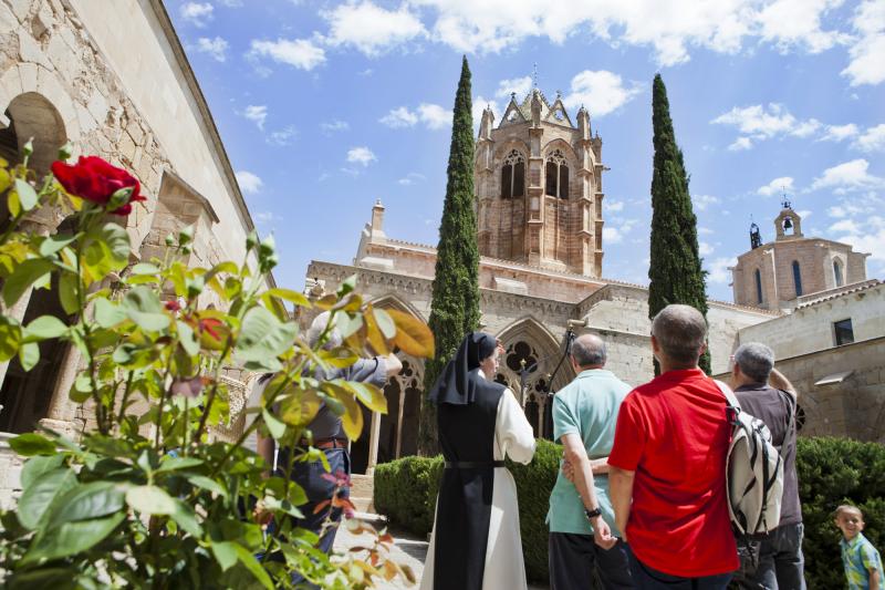
Accommodations in Vallbona. There are several bars and restaurants.
- Hospedería de Vallbona y Refugio Sant Bernat - Tel. 973 33 02 66/618 876 004 - De lunes a viernes, de 10h a 12h - http://www.monestirvallbona.cat/ca/hostatgeria.html - BOOKING - CHECK-IN BEFORE 18.00 PM.
Accommodations in Rocallaura. There is a bar.
- Oca Rocallaura Spa**** - Tel. 973 33 06 32 - http://ocahotels.com/hoteles/espana/lleida/vallbona-de-les-monges/oca-rocallaura/www.ocahotels.com
- Pensión Antiguo Balneario de Rocallaura P * - Tel. 973 33 02 14/977 60 17 34 - www.anticbalnearirocallaura.com
Others accommodations in Belltall (a 10 km de Vallbona y a 4 km de Rocallaura). Hay un restaurante.
- Hostal Feliuet P ** HT000726. Tel. 977 89 27 05 - www.calfeliuet.com
Others accommodations in Forès (to 15.600 km from Vallbona and 9 km from Rocallaura). There is a restaurant.
- Refugio la Abadía (municipal). Tel. 977 89 27 62| 630 722 409 - www.fores.cat
RECOMENDATIONS:
- This route is apt for any participant who is used to hiking as it does not entail any more difficulty than the distance to be covered and moderate gradients.
- The route should be designed, more or less, in stages and taking into account the number of days you have available, your goals and your physical preparation. The route can be done in both directions.
- Cyclists have 4 bypasses that have been planned for the most complicated parts, but they still require a certain amount of effort and physical preparation.
- Saddlebags are not recommended. If you want you can contract shuttle service luggage and bicycles. Drac Actiu: +34 629 213 263.
- You should get weather forecast information.
- You should take enough eater for the route and drink regularly.
- You should usesun cream.
- You should book accommodation.
- There are many villages with no shops, restaurants......to have a snack.
- Many establishments are closed on Mondays.
- Many establishments do not accept credit cards. There are cash machines in: El Pla de Santa Maria, Montblanc, l'Espluga de Francolíand in Pont d'Armentera.
- The itinerary is signposted with the characteristic GR white and red signs, with directional post that are very clearly identified that, moreover, give information about the place and the altitude.
- You should respect the environment and the norms established by Poblet Nature Park and the by the owners of properties that you pass through.
- Emergency telephone number : 112.
- For any suggestions, incidents or anomalies, please contact: info@larutadelcister.info and by phone on: 977 87 12 47.